


Towering Insights for Paludiculture
Christian Brümmer keeps track of which greenhouse gases are emitted by terrestrial ecosystems across Germany and feeds this data into the European monitoring network ICOS. Now, the number of monitoring stations in the country is set to more than double almost overnight—primarily through the installation of eddy covariance towers on paludiculture sites. Christian explains why.
Christian, what is ICOS?
ICOS stands for Integrated Carbon Observation System. It is a European network and research infrastructure that uses standardized technology to measure greenhouse gases. A total of 16 countries participate and provide their data. At the Thünen Institute of Climate-Smart Agriculture in Braunschweig, I coordinate Germany’s contribution to ICOS and, in this context, lead the micrometeorological monitoring of greenhouse gases and air pollutants. We observe greenhouse gas fluxes between cropland, grassland, forests, and peatlands and the atmosphere.
Why all these complex and laborious measurements, anyway?
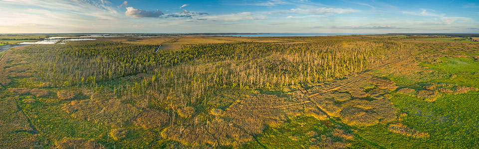
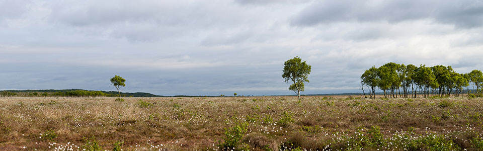
Everyone is always talking about greenhouse gas emissions and CO2 reductions. To achieve this, we need to know where these climate-damaging gases come from, at what magnitudes they are produced, and what we can do to reduce them. For example, managing ecosystems in such a way that they become sinks—absorbing more CO2 than they emit. Forests are well-suited for this, but also wet peatlands. Due to large-scale drainage in the past, the organic soils in those areas are now relatively dry and have unfortunately become major sources of CO2.
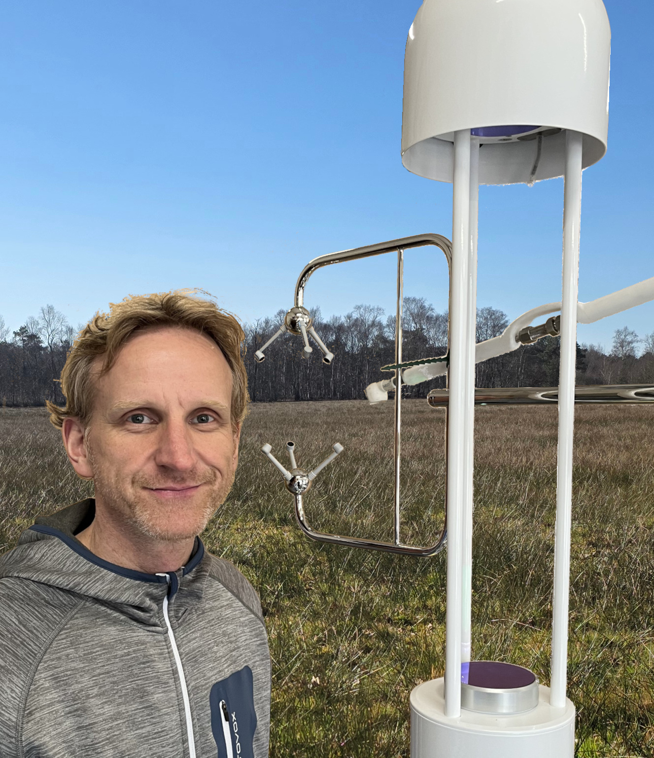
Measurements are taken using so-called eddy covariance towers - how many of these have been installed so far as part of ICOS?
Twenty-two so far. Most are located in forests and on grasslands. There are many more that are not part of ICOS.
Now the number is nearly doubling - why specifically on paludiculture sites?
Nearly 30 measurement towers are now being installed at peatland sites, which is truly spectacular. They are located on paludiculture and reference plots, i.e., on drained agricultural peat soils. They will be in operation for the next eight years. This will yield a globally unique dataset. Until now, these measurements have only been conducted in smaller projects over shorter periods.
Why are GHG measurements so important here in particular?
This is important because we don’t want to lose land that is already in use, but we must find sustainable and climate-friendly ways to utilize it. Paludiculture offers a solution here, whether through the cultivation of cattails, reeds, and peat mosses or as wet meadows. Their climate-protective effects now need to be systematically recorded and documented. We are ensuring this through a work package of the joint research project PaludiZentrale, in which nine research and implementation projects on paludiculture contribute greenhouse gas data. Biodiversity, hydrology, socioeconomics, utilization, and other agricultural aspects are also considered within this framework.
How does such a setup work, and what exactly is measured?
In short: The eddy covariance towers in the field primarily consist of an anemometer and greenhouse gas analyzers. They measure local turbulence - that is, the three-dimensional wind field - as well as greenhouse gas concentrations. From this, we can determine, for example, the uptake of CO2 from the atmosphere or the release (emission) from the ecosystem into the atmosphere. This is quite complicated. Ultimately, we’re counting molecules that are swirled in both directions. The measurements represent a specific area of the field where the tower is located. We call this the footprint. It depends on wind speed and wind direction. For the local greenhouse gas or carbon balance, additional information such as crop yield is important. We also consider water levels, precipitation, temperature, and radiation. All these factors influence greenhouse gas exchange.
A system like this requires electricity, which is always a challenge. If there is power access nearby, we place cables underground. If not, photovoltaic modules must be installed. Once the system is up and running, we can access the measurements from the office. However, on-site maintenance is performed approximately every two weeks to, for example, remove cobwebs and clean the lenses.
Why is it important to understand how harvesting affects land?
In peatlands, the goal is to sequester carbon as peat. In fens, this is primarily formed from underground biomass. However, on agriculturally used land - including paludiculture - above-ground biomass is removed by harvest. This initially represents a loss of carbon for the area, which we must factor into the balance. If it is permanently sequestered in a subsequent application for the next 10–20 years, such as in an insulation board, then that’s great too. Because - where, or rather, how do we want the carbon to be? Definitely sequestered, but not released into the atmosphere! Because there, it contributes to further global warming.
How exactly is the measurement data used?
Germany is required to report emissions from all sectors - including transportation, industry, and land use - in a national greenhouse gas inventory. This allows us to assess whether Germany has met the targets of the Climate Action Act or whether further measures are necessary. Data is available for this purpose, and for each sector there are factors that can be used to scale emissions for the entire country. However, these emission factors do not yet exist for paludiculture. Developing such factors is our goal - ideally differentiated by type of paludiculture. And in the best-case scenario, these factors will demonstrate the climate-beneficial impact of paludiculture, as emissions are significantly reduced compared to conventional peatland use.
That sounds a bit tedious - is this work actually fun?
It’s totally fun, and I’ve been doing nothing else for 15 years! It combines technology, ecology, and complex data analysis. Part of the time, I’m out in nature with colleagues using highly advanced measurement technology. This gives us a wealth of information about how human actions - specifically through land use - directly impact our climate.
When will we be able to draw first conclusions about the paludiculture sites?
The balancing is done on an annual basis, primarily for CO2 and methane, and for reference sites, nitrous oxide as well. We will soon have the first complete annual data sets from the new eddy towers in our database. Then we may already be able to see which type of paludiculture has the highest impact on the climate.
The interview was conducted by Nina Körner.